How to Sell the Wooded, Swampy, “Wall-of-Trees” Parcels Everyone Else Scrolls Past
There’s a photo every land seller has taken.
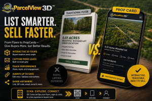
You drive out to a parcel, walk to the edge of the road, lift your phone, and snap the listing photo. And what comes back is… a wall of trees. Or a flat brown field that stretches to a gray horizon. Or a ditch with some scrub. You look at the image, then back at the actual land in front of you — land with a creek running through it, a natural clearing perfect for a cabin, a gentle rise with a view — and you think: the camera didn’t capture any of that.
So you post it anyway. It sits. Buyers scroll past in half a second because to them, it reads as “nothing.” Eventually you drop the price. Twice. It finally sells for a fraction of what it’s worth to the one person who bothered to drive out and see it in person.
Here’s the reframe that changes everything: there is no such thing as ugly land. There’s only land your camera can’t tell the truth about.
A photo is a 2D lie about a 3D thing. It can’t show terrain. It can’t show scale. It can’t show what’s behind the tree line, whether you can build on it, or what it would feel like to live there. Every “ugly” parcel is just a parcel whose best qualities are invisible to a flat image — and that’s a presentation problem, not a property problem.
ParcelView3D exists to solve exactly that. Let’s walk through the six things that make land “unsellable” in photos — and how PV3D turns each one into a selling point.
See the difference for yourself. Grab the live demo, drag the terrain around, and toggle the overlays before you read on: parcelview3d.com/demo — or play with the live parcel embedded on the ParcelView3D homepage.
Problem #1: “It’s just a wall of trees.”
The single most common ugly-land photo is dense woods. From the road, you literally cannot see the land — so the buyer assumes there’s nothing worth seeing.
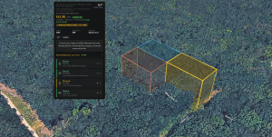
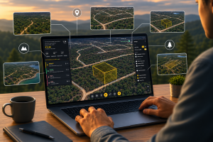
PV3D’s answer: a true 3D terrain model built from real elevation and satellite data. Instead of standing at the road, the buyer floats above the parcel and sees the actual shape of the ground — the clearing in the middle, the slope down to the creek, the flat buildable bench near the back. Add a cinematic flyover video, and now that “wall of trees” becomes a 60-second aerial tour that reveals everything the phone photo hid.
The trees didn’t change. The buyer’s ability to see past them did.
Problem #2: “Isn’t that a swamp? Isn’t it in a flood zone?”
Nothing kills a land deal faster than an unanswered fear. When a parcel looks low, wet, or wooded, buyers assume the worst — flood zone, wetlands, unbuildable — and they don’t ask, they just leave.
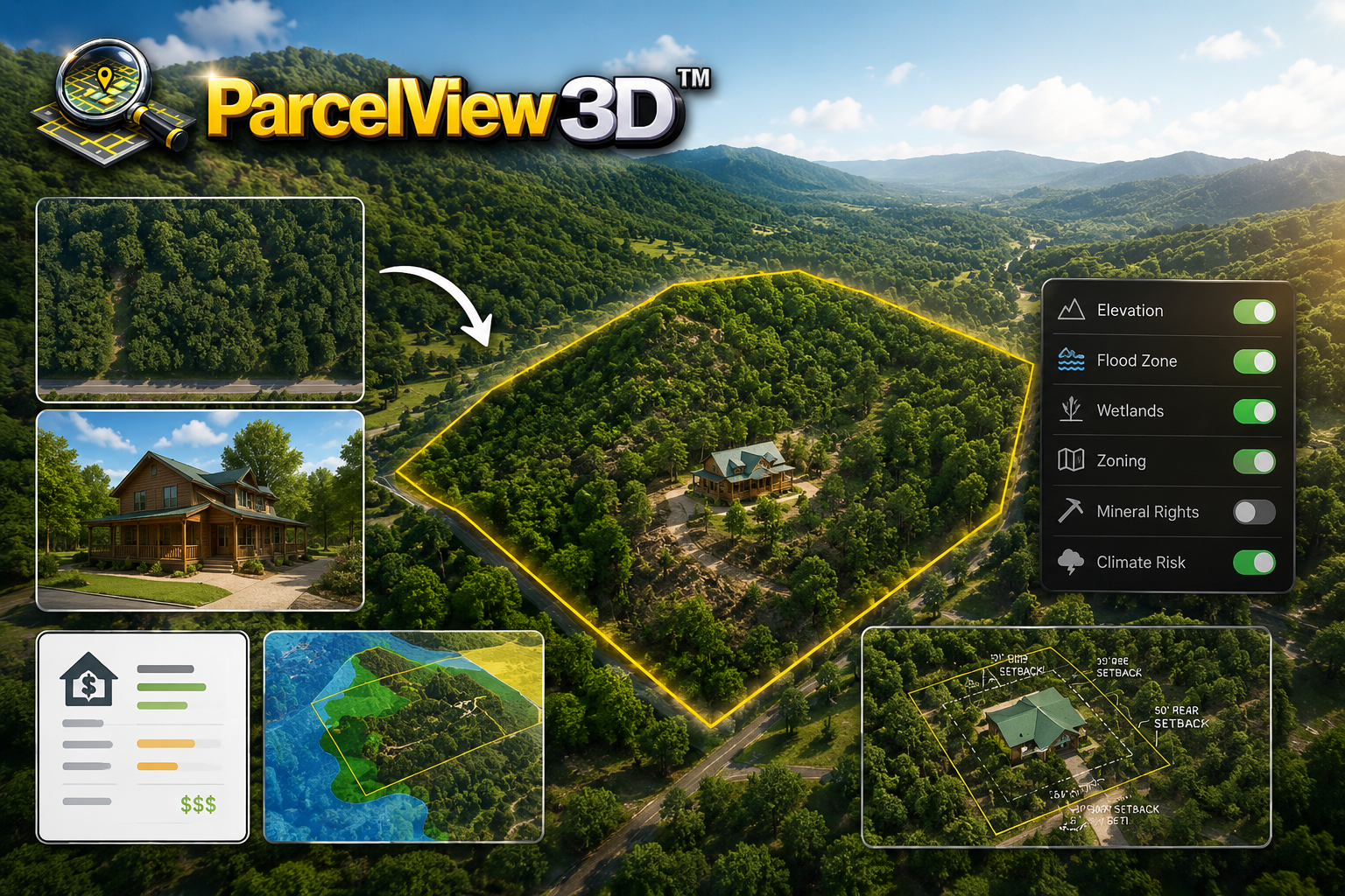
PV3D’s answer: toggleable overlays for flood, wetlands, zoning, mineral rights, and climate risk, rendered right on the parcel. Instead of the buyer wondering whether it’s in the floodplain, they can see it with their own eyes — and when the parcel sits safely above the line, that’s no longer a scary question. It’s a selling point you’ve answered before it was ever asked.
You’re not hiding the ugly rumor. You’re replacing it with the truth, on-screen, in context.
Problem #3: “I can’t picture myself living there.”
Raw dirt requires imagination, and most buyers don’t have much. A bare parcel photo asks them to mentally build a home, clear a driveway, and plant a garden — and if they can’t do that in their head, they move on.
PV3D’s answer: AI concept renderings. With a click, that empty clearing gets a cabin, a homestead, an off-grid retreat, or an ADU dropped onto it — a photorealistic vision of what the land could become. You’re no longer selling dirt. You’re selling the dream the dirt makes possible, and you’re doing the imagining for the buyer so they don’t have to.
Problem #4: “Okay… but is it even buildable?”
A wooded, sloped, or oddly shaped lot raises the scariest question of all: can I actually do anything with it? Photos can’t answer that. So the serious buyer — the one who’d actually pay — hesitates.
PV3D’s answer: the Site Planner. Sketch a buildable footprint directly on the parcel, drop in an ADU or home template from the catalog, and see the setbacks rendered as leader lines so there’s no guessing about what fits. Pair it with well and septic suitability flags, and the buyer stops asking “is this buildable?” because you’ve just shown them exactly what they can build and where.
Export it to a PDF and you’ve handed them a mini due-diligence packet before they’ve even called.
Problem #5: “What would it cost to build out here?”
Even when a buyer loves the land, sticker-shock anxiety about construction stops the deal. And “call a few contractors for quotes” is a week-long errand most buyers never finish.
PV3D’s answer: the Cost Estimator produces county-aware construction cost estimates right on the listing — no cold-calling contractors, no waiting. The buyer gets a realistic sense of the all-in number in the same session they fell in love with the parcel, while the excitement is still high. Momentum is everything in land, and this keeps it alive.
Problem #6: “It’s landlocked / a weird shape / five little lots.”
Some parcels are ugly on paper — an odd flag shape, a strip that looks tiny in a photo, or a cluster of five adjoining lots that individually look like nothing.
PV3D’s answer: crisp 3D boundaries make scale and shape instantly legible (that “tiny strip” is actually 12 acres deep). And for adjoining lots, you can bundle and link them into a single package listing — so instead of five lonely, unsellable parcels, you’re presenting one compelling homestead-sized opportunity with one 3D story.
A worked example: the $8k parcel nobody wanted
Picture a wooded, sloping 5-acre lot that had been listed for months. The road-level photo was a green wall. Two price drops, zero offers.
Re-listed through PV3D, the same parcel told a completely different story:
- The 3D view + flyover revealed a flat building pad near the top with a long-range view the photo never showed.
- The flood overlay confirmed it sat well above the zone — killing the “is it swampy?” fear on sight.
- An AI concept dropped a small cabin on the pad, and suddenly buyers were picturing weekends there.
- The Site Planner showed the driveway path and a buildable footprint that cleared setbacks easily.
- The Cost Estimator gave a ballpark build number so nobody had to guess.
Nothing about the land changed. What changed was that buyers could finally see it. The parcel that photographed like nothing sold — because it stopped being presented like nothing.
The takeaway: you don’t have ugly land, you have unrendered land
Every discounted, sat-on, price-dropped parcel in your portfolio has the same thing in common: a flat image made it look like less than it is. The camera lied, and buyers believed it.
The fix isn’t a better camera or a drone road-trip. It’s giving buyers a way to see the truth — the terrain, the clearing, the buildable pad, the dream — in a way a 2D photo physically cannot.
Take the parcel you’re most tired of looking at and run it through PV3D. Paste the APN, and watch your “ugly” lot render into something a buyer can finally understand and fall for.
➡ Explore the live ParcelView3D demo
Or point it at your own worst listing — start your 7-day free trial (no card required, up to 3 properties free) and see what your camera’s been hiding.
Built by land investors, for land investors