A side-by-side look at features, pricing, and real-world use cases — so you can choose the platform that fits how you work.
Updated April 2026 | 1,400+ words | 8 min read
| QUICK VERDICT | PV3D: Best for listings & buyer engagement | Land ID: Best for research & field use |
The Big Picture
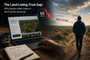
If you’re selling land — whether raw acreage in Texas, rural lots in Tennessee, or owner-financed tracts in Florida — the question isn’t just which mapping tool looks nicer. It’s which one helps you close more deals. And for that, it helps to understand what each platform was designed to do.
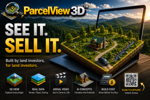
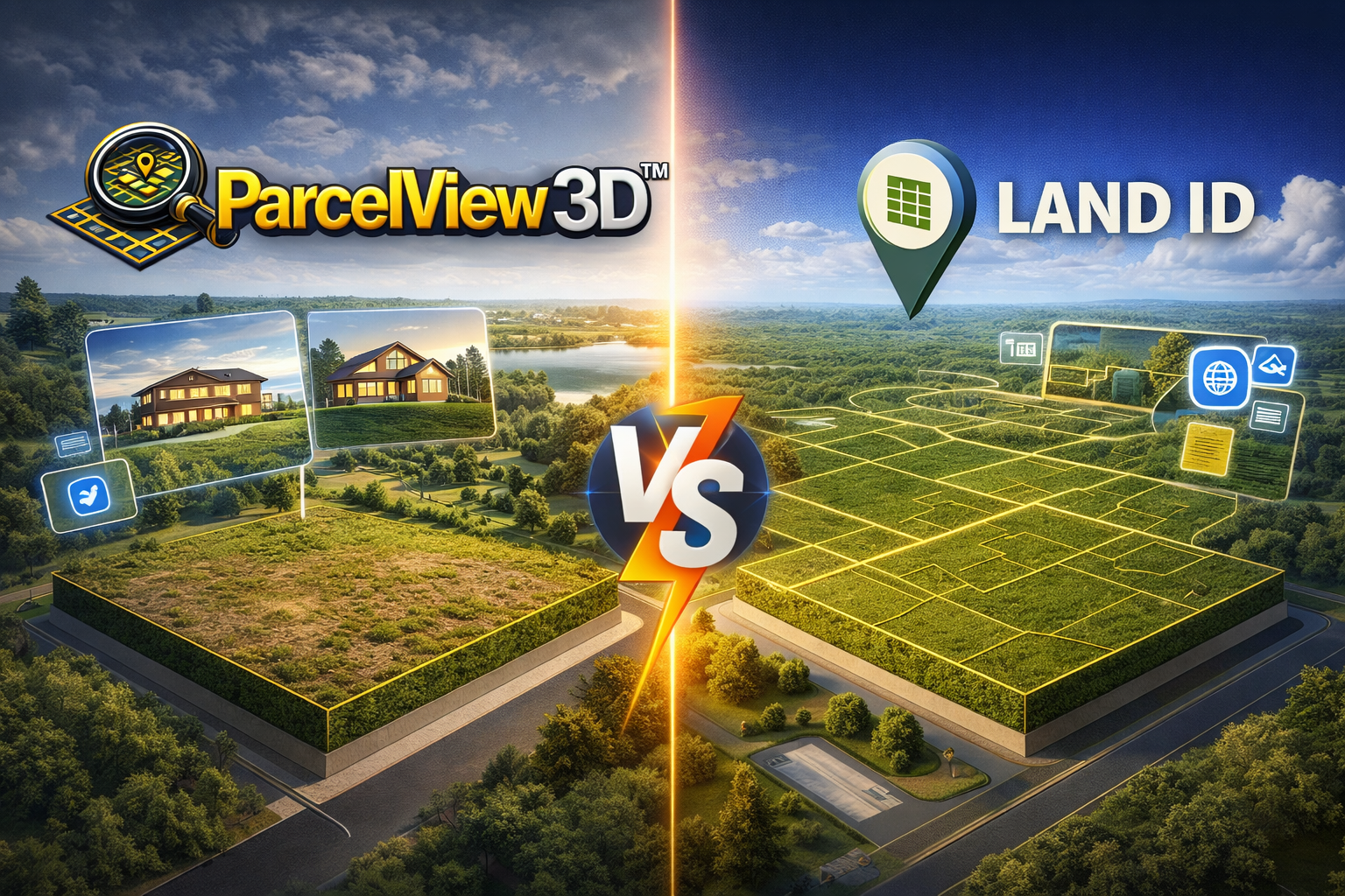
ParcelView 3D is a listing-first platform, purpose-built for land buyers, sellers, and investors. It takes a property from coordinates to an immersive, shareable 3D showcase in under a minute. Every feature — from smooth flyover animations to AI-generated concept images to cinematic video clips — exists to help a buyer visualize, emotionally connect with, and ultimately purchase a piece of land they may never have visited in person.
Land ID (formerly MapRight) is a data-first platform with deep roots in parcel research, boundary mapping, and field navigation. It’s a capable tool for real estate professionals who need to study a property thoroughly before buying, selling, or advising on it.
This comparison breaks down the two platforms across five dimensions that matter most to land investors: 3D visualization, AI-powered content creation, listing experience, research depth, and pricing.
3D Visualization: A Different Experience Entirely
This is where the two platforms feel most different. ParcelView 3D delivers a fully immersive, photorealistic 3D experience. Valleys, ridgelines, creek bottoms, and hilltops render in genuine three-dimensional space, and the automated flyover orbits each property at a cinematic camera angle that a flat map simply can’t replicate. It’s built from the ground up around the idea that a buyer should feel the land before they ever set foot on it.
Land ID offers a “3D Tour” mode on its Pro plans — a useful elevation-aware view with a fly-around animation that complements its broader mapping toolkit. Users who have used both platforms generally describe Land ID’s 3D view as a helpful supplement to its research tools, while ParcelView 3D’s 3D view is the main event — the feature the entire platform is designed around.
| ParcelView 3D Advantage: Immersive Terrain Experience
Every property has genuine topographic depth — hills look like hills, flat pasture looks flat, and buyers can orbit the land naturally. This is the experience that stops a buyer from scrolling past a listing and keeps them engaged. |
AI-Powered Content Creation
ParcelView 3D ships with two AI content tools that Land ID doesn’t currently offer: the Concept Builder and the AI Video Creator. The Concept Builder lets you upload a property image and generate HD renderings showing what a ranch home, modern cabin, or barndominium could look like on that land — complete with driveways, landscaping, and realistic shadows. These images are marketing gold for owner-financed land sellers whose buyers are often making purchase decisions from a couch in another state.
The AI Video Creator turns still property views into 10-second cinematic flyover clips with motion, lighting changes, and atmosphere. On paid plans, you get 20 AI videos per month — enough to give every new listing a fresh, differentiated piece of content for Facebook, Instagram, or your own website.
Land ID’s focus is on data visualization rather than creative content generation, so if your goal is to market land to retail buyers, this is a meaningful area where ParcelView 3D pulls ahead.
| The AI Advantage Explained
Land investors selling owner-financed lots often work with buyers who can’t or won’t visit the property before purchase. An AI-generated concept image showing a cabin on a specific parcel answers the buyer’s biggest question: “Can I picture myself there?” That one question, answered visually, closes more deals. |
Data Depth & Research Tools
This is Land ID’s strongest area. With ownership and boundary information on more than 155 million parcels across all 50 states, plus 40+ data layers covering soils, FEMA floodplains, wetlands, topography, fiber availability, and tax history, Land ID is the tool many professionals reach for when they need to understand a property in depth.
Its Smart Search — which lets you query by address, APN, owner name, or coordinates — is genuinely useful for acquisition research. The comp report generator surfaces comparable sales and helps justify pricing. For appraisers, surveyors, and investors doing pre-acquisition due diligence, these capabilities are valuable.
ParcelView 3D’s focus is narrower and more listing-centric. It provides the property information, view analytics, and boundary tools you need to create compelling listings — everything a land seller needs to market a property effectively. For heavier pre-purchase research on acquisitions, Land ID is a strong complement.
| Land ID Advantage: Research Depth
Extensive data layers, a large parcel database, offline mobile access, mailing list generation, and comp reports make Land ID a solid research tool for land professionals who need to know everything before committing to a purchase. |
Listing Experience & Buyer Engagement
Both platforms let you embed interactive maps into a listing page, but the experience each one delivers is meaningfully different. A ParcelView 3D listing drops a fully animated, flyover-enabled 3D viewer right into your page — buyers can orbit the property, explore the terrain, and interact with boundary overlays without ever leaving. It’s designed to feel like an immersive product demo.
Land ID’s embeddable maps (on Pro plans) are data-rich and excellent for conveying information — layers, boundaries, attributes. A Land ID embed is something a serious buyer explores carefully. A ParcelView 3D embed is something a casual browser stops and watches — and that difference often determines whether a listing generates inquiries.
ParcelView 3D also provides a dedicated branded listing page, PropCards with QR-code-linked property summaries, and view analytics that tell you exactly which listings are generating the most interest. These seller-side tools are part of what makes it purpose-built for land marketing.
Feature-by-Feature Comparison
✓ = Included ✗ = Not available Partial = Limited or add-on
| Feature | ParcelView 3D | Land ID |
| 3D VISUALIZATION | ||
| Photorealistic 3D terrain view | ✓ | ✗ |
| Automated flyover animation | ✓ | Partial |
| Immersive 3D boundary display | ✓ | ✗ |
| Street View / Ground View | ✓ | ✓ |
| AI CONTENT CREATION | ||
| AI concept image generator | ✓ | ✗ |
| AI cinematic video creator | ✓ | ✗ |
| AI-powered comp reports | ✗ | ✓ |
| AI Smart Search (owner/APN) | Partial | ✓ |
| DATA & RESEARCH | ||
| Parcel data — all 50 states | ✓ | ✓ |
| 40+ data layers (soils, flood, etc.) | Partial | ✓ |
| Ownership & tax history | Partial | ✓ |
| Offline mobile access | ✗ | ✓ |
| Mailing list generation | Partial | ✓ |
| MARKETING & LISTING TOOLS | ||
| Embeddable interactive viewer | ✓ | ✓ (Pro) |
| Branded listing page | ✓ | ✗ |
| PropCard + QR code | ✓ | ✗ |
| HD screenshot capture | ✓ | ✓ |
| In-browser video recording | ✓ | ✗ |
| Voice narration overlay | ✓ (Pro) | ✗ |
| View analytics per listing | ✓ | ✗ |
| PLATFORM & ACCESS | ||
| Web platform | ✓ | ✓ |
| Mobile app (iOS/Android) | ✓ | ✓ |
| Website integration | ✓ | Partial |
| Developer access (Pro tier) | ✓ | ✓ |
Pricing: Simple vs Layered
ParcelView 3D uses a straightforward tiered model starting at $9/month, scaled by the number of properties and monthly views. Land ID uses a persona-based model starting at $7/month for mobile-only access, scaling to $49.99/month for Pro and $79.99/month for Pro Unlimited.
At comparable capability levels, the two platforms sit in a similar price range — but ParcelView 3D’s pricing is easier to understand at a glance and includes AI features at every paid tier.
| ParcelView 3D | Land ID |
| Basic (3 properties) — $9/mo | Base (mobile only) — $7/mo |
| Standard (10 properties) — $19/mo | Premium (3 maps, no embed) — ~$15/mo |
| Starter (25 properties) — $49/mo | Pro (embed + branding) — $33–$50/mo |
| Growth (50 properties) — $99/mo | Pro Unlimited — $67–$80/mo |
| Pro (100 properties) — $199/mo | Mailing lists — $0.07/record |
Who Should Use Which Tool?
Choose ParcelView 3D if you are:
- An owner-financed land seller who lists properties on your own website and needs buyers to emotionally connect with land they haven’t seen in person
- A land investor who values marketing assets — AI concept images, cinematic videos, immersive 3D viewing — as the primary way to differentiate listings
- A website owner who wants a clean, embeddable listing experience that works naturally inside your existing site
- Selling anywhere from 5 to 100+ properties at a time and want a clean dashboard to track views, manage listings, and generate content
Choose Land ID if you are:
- A land broker or agent who researches dozens of properties before recommending one to a client
- An investor doing heavy due diligence — floodplains, soil types, easements, ownership chains — before committing to an acquisition
- Someone who needs offline mobile access to navigate to and around rural properties in the field
- A surveyor, appraiser, or agricultural professional who needs granular data layers and printable high-res maps
| Power Move: Use Both
Many serious land investors use both platforms. Land ID to research and acquire, ParcelView 3D to market and sell. They serve different stages of the same pipeline — and at under $100/month combined for most use cases, the pairing gives you a significant edge over competitors using neither. |
The Bottom Line
If you’re choosing one tool to close more land deals, ParcelView 3D is built for exactly that.
If you’re choosing one tool to know everything about a property before you buy it, Land ID is the answer.
| BEST FOR SELLING LAND
ParcelView 3D Immersive 3D viewing, AI concept images, cinematic video, embeddable listings, and view analytics. |
BEST FOR RESEARCHING LAND
Land ID Extensive parcel records, deep data layers, offline mobile access, comp reports, and mailing lists. |
Try ParcelView 3D NOW: parcelview3d.com