If you’ve ever researched land online, you’ve probably used free mapping tools like Google Maps, county GIS websites, or other public map platforms. These tools are great for basic navigation and getting a quick look at an area, but when it comes to serious land research, they often fall short.
That’s where ParcelView 3D stands out.
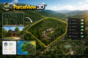
ParcelView 3D is designed specifically for people who want a better way to explore and understand land. Instead of just showing a flat overhead image, it provides an immersive 3D experience that helps users visualize terrain, surrounding areas, elevation, and parcel layouts more clearly.
For land investors, developers, real estate professionals, and rural property buyers, that extra level of detail can make a huge difference.
Free mapping tools are useful for:
• Looking up addresses
• Checking directions
• Viewing satellite imagery
• Exploring neighborhoods
• Basic property browsing
They work well for casual use, but most were never built specifically for land investing or parcel analysis.
Common limitations include:
• Limited terrain detail
• Confusing parcel overlays
• Flat imagery
• Cluttered interfaces
• Multiple websites needed for research
When evaluating vacant land, especially rural property, users often need more context than free tools provide.
Why ParcelView 3D Is Different
ParcelView 3D focuses entirely on helping users better understand land.
The platform allows users to:
• Explore properties in immersive 3D
• View terrain and elevation naturally
• Understand nearby surroundings
• Visualize parcel placement
• Review land more efficiently
Instead of piecing together information from several free websites, ParcelView 3D creates a smoother and more professional property research experience.
Website:
https://parcelview3d.com/
Feature Comparison
| Feature | ParcelView 3D | Free Mapping Tools |
|---|---|---|
| 3D Land Visualization | ✅ Advanced | ⚠️ Basic |
| Parcel-Focused Experience | ✅ Yes | ❌ Limited |
| Terrain Exploration | ✅ Interactive | ⚠️ Minimal |
| Rural Land Research | ✅ Excellent | ⚠️ Inconsistent |
| Easy Parcel Navigation | ✅ Streamlined | ⚠️ Often Clunky |
| Property Research Workflow | ✅ Optimized | ❌ Fragmented |
| Real Estate Use Cases | ✅ Built for Land Buyers | ⚠️ General Use |
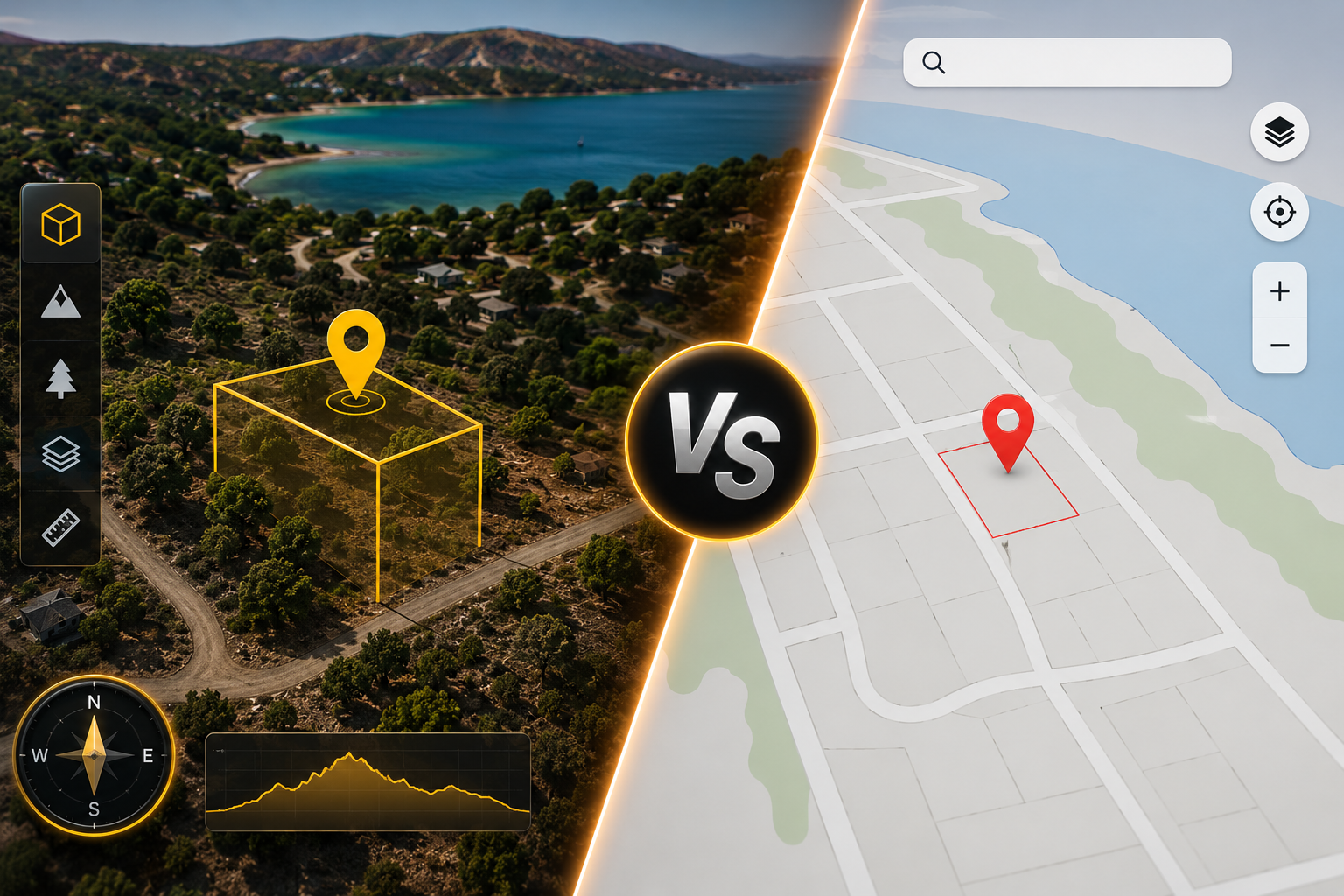
Better Terrain Visualization
One of the biggest advantages of ParcelView 3D is terrain visualization.
With many free mapping tools, land appears flat and difficult to interpret. That can make it hard to understand:
• Slopes
• Hills
• Valleys
• Buildable areas
• Access points
• Natural surroundings
ParcelView 3D gives users a more realistic perspective of the property, helping them better evaluate land before visiting in person.
This is especially valuable for:
• Recreational land
• Hunting property
• Off-grid land
• Cabin sites
• Rural acreage
• Development projects
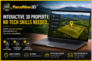
Faster Land Research
Free tools often require users to jump between multiple websites:
• County parcel maps
• Satellite viewers
• Terrain tools
• Public GIS systems
This slows down the research process.
ParcelView 3D simplifies property exploration by creating a more focused workflow designed specifically for land buyers and investors.
Users can review parcels more efficiently and spend less time piecing information together manually.
Easier Property Understanding
When researching vacant land, context matters.
Buyers want to understand:
• What surrounds the property
• Nearby roads and access
• Terrain flow
• Nearby development
• The overall feel of the land
ParcelView 3D helps users better visualize these details through immersive property viewing, making land easier to evaluate and compare.
Best for Land Buyers & Investors
ParcelView 3D is especially useful for:
• Land investors
• Realtors
• Developers
• Rural property buyers
• Recreational land buyers
• Real estate marketers
While free mapping tools are helpful for general browsing, ParcelView 3D is built specifically for people who need a more advanced and property-focused land research experience.
Final Thoughts
Free mapping tools are great for casual use and simple navigation, but they often lack the depth needed for serious land research.
ParcelView 3D provides a more immersive, modern, and land-focused experience that helps users:
• Understand terrain better
• Explore parcels faster
• Improve land due diligence
• Make more informed decisions
For anyone researching vacant land regularly, ParcelView 3D offers a major advantage over traditional free mapping tools.
Explore ParcelView 3D today:
https://parcelview3d.com/