The land investment industry is undergoing a visual revolution. Static maps are out — immersive 3D property viewers are in. Here’s why the shift is happening now, what buyers expect, and how forward-thinking land investors are using 3D technology to close more deals faster.
ParcelView3D Editorial · 1,400-word read
The Problem With How Land Has Always Been Sold
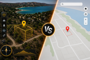
For most of the internet era, selling vacant land online has followed a predictable playbook: upload a few aerial photos, embed a Google Maps screenshot, write a description that starts with “This beautiful parcel…”, and hope that buyers can somehow visualize themselves standing on 10 acres of raw Texas dirt through a 600×400 pixel static image.
It has worked — barely. The land investment space has historically tolerated this friction because the alternative was driving out to a property, which is worse. But buyer expectations have shifted dramatically. The same customer comparing your listing is also shopping on platforms that show them 3D walkthroughs of homes, interactive neighborhood maps, and satellite flyovers. The static map is starting to look embarrassing by comparison.
The visualization gap between residential real estate and land is no longer a minor inconvenience — it’s a conversion killer. And for the first time, the tools to close that gap are accessible to small and mid-sized land investors, not just institutional players with custom GIS software.

What Buyers Are Actually Trying to Understand
When a buyer lands on a land listing, they’re not looking for a map. Maps tell them where something is. What they desperately want to know is what it feels like to own it.
Is there a ridge line? Does it slope down to the creek, or is the low-lying area in the back corner where the flood risk might be? How does the tree coverage look from above — is it dense timber or scattered scrub? Where does the sun set relative to the road frontage?
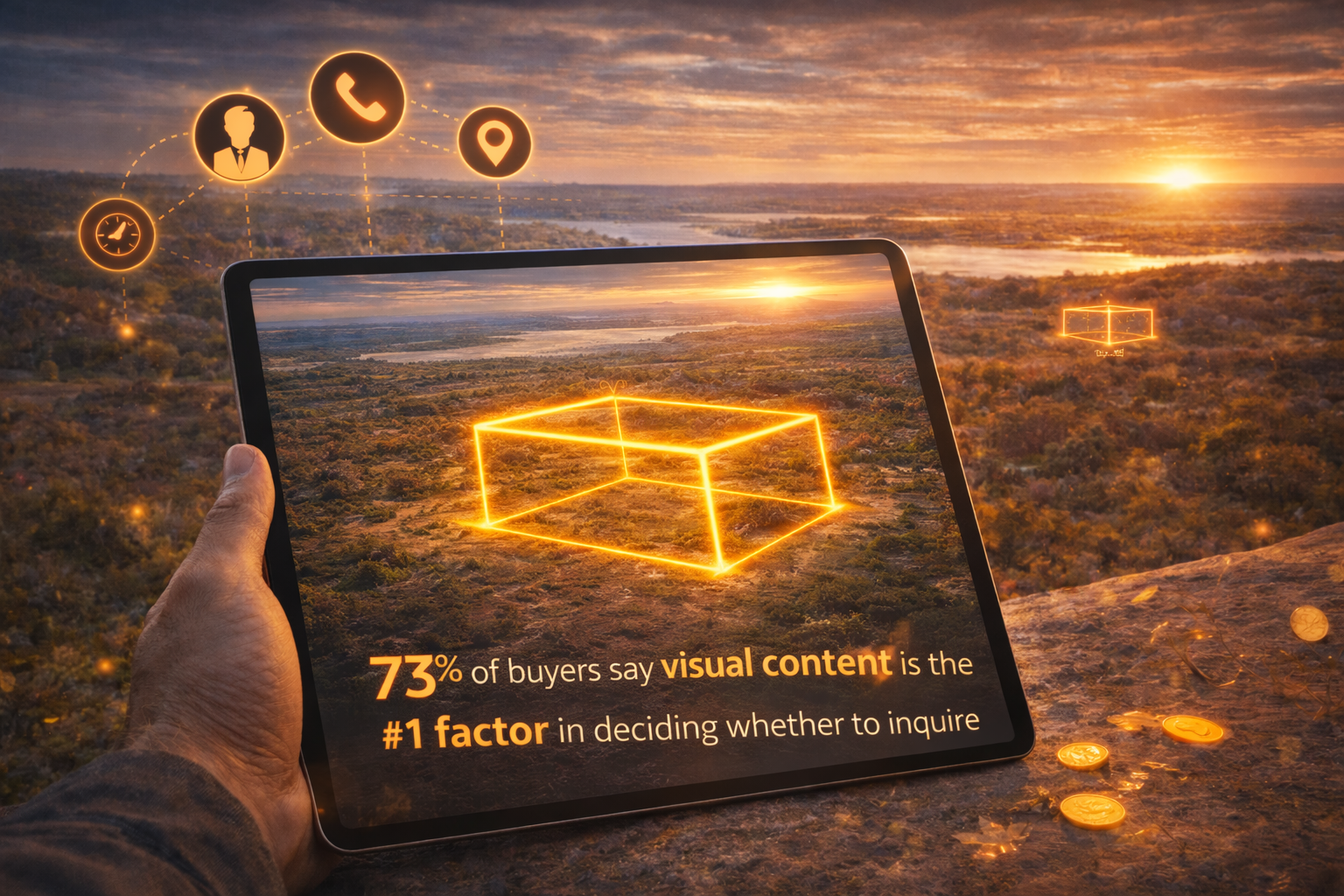
None of these questions are answered by a 2D satellite screenshot. They require spatial awareness — the ability to tilt, rotate, zoom, and fly over a property to build a genuine mental model of the land. That’s exactly what photorealistic 3D visualization delivers.
“Static maps tell buyers where a property is. A 3D viewer makes them feel like they’ve already been there — and that emotional ownership is what drives offers.”
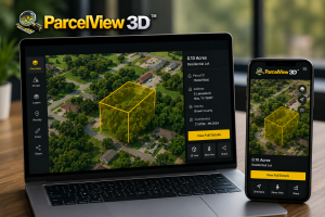
Tools like ParcelView3D are powered by Google Maps 3D Tiles, which combine satellite imagery with real terrain elevation data to produce accurate topographic representations of land. A buyer in New Jersey looking at a Tennessee hillside property can explore the ridgeline in three dimensions, see how the elevation changes across the parcel, and leave the listing with a genuine spatial understanding they couldn’t get from any flat image.
The Rise of the Remote Land Buyer
The remote buyer trend — already accelerating through 2022–2024 — has permanently reshaped the land investment market. Owner-financed rural land, in particular, has seen a surge of buyers who purchase entirely sight-unseen. They don’t have the budget to fly to Oklahoma to walk 5 acres before deciding on a $15,000 parcel. The listing itself has to do the full selling job.
This changes the stakes of visualization dramatically. A residential real estate buyer in the same city as the listing can always schedule a showing. Your land buyer in Minnesota looking at your Texas parcel cannot. Every piece of visual content you publish is the only site visit they’re going to get.
- Buyers need to understand topography before they’ll commit — especially for owner-financed purchases where they’re signing a contract without physically visiting
- Property boundary clarity is critical — buyers want to know exactly what they’re buying, and hand-drawn maps don’t cut it anymore
- Surrounding area context matters — what’s adjacent to the parcel? Is it development, timber, other residential lots?
- Access and road frontage visualization closes objections before they become questions that kill the deal
3D viewers address all four of these buyer anxieties in a single embeddable widget. The property boundary overlay in ParcelView3D renders the exact parcel edges as extruded polygons floating over the terrain — there’s no ambiguity about where the property begins and ends. The automated flyover animation gives the surrounding area context that no static image can replicate.
AI Visualization: The Next Layer
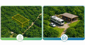
Beyond 3D terrain, a new category of land marketing technology is emerging that goes even further: AI concept visualization. The core insight is simple but powerful — most land buyers aren’t buying raw acreage for its own sake. They’re buying a future. They want to build a cabin, park an RV, raise animals, or one day retire on that land. Showing them a photorealistic AI-generated rendering of what that future could look like is one of the highest-converting things a land seller can do.
The Concept Builder feature addresses this directly: upload a real photo of the property, select a home style (ranch, modern farmhouse, cabin, barndominium), and generate HD AI images of the property with a home, driveway, and landscaping already on it. For buyers who need help visualizing the potential, this is the difference between a mental maybe and an emotional yes.
Paired with AI video tools that turn still property images into 10-second cinematic flyover videos, land sellers now have a complete visual marketing stack that was completely out of reach — even for well-funded operations — just three years ago.
View Analytics: Knowing What’s Working
One underappreciated benefit of moving from static images to 3D viewers is the data. A JPEG embed tells you nothing. A live 3D viewer embedded on your listing page tells you exactly how many people viewed each property, which listings are getting the most engagement, and — by correlation — which properties have buyer interest that hasn’t yet converted to an inquiry.
For land investors managing dozens of active listings across multiple states, this kind of granular engagement data is genuinely valuable for prioritizing follow-up, adjusting pricing, and deciding which parcels need refreshed marketing creative. The feedback loop that residential agents have always had through showing metrics is now available to land investors operating entirely online.
The Competitive Moat Is Still Open — But Closing Fast
Here’s the honest market reality in 2026: most land sellers are still using static images and embedded Google Maps links. The gap between what leading operators are doing with 3D visualization and AI concept imagery versus what the average land seller is publishing is enormous. That gap represents an opportunity.
Buyers who encounter a ParcelView3D embed on a listing — especially if they’ve been browsing competing listings with flat maps — experience a genuine pattern interrupt. The listing feels more credible, more professional, and more worthy of serious attention. That credibility differential converts to inquiries at a measurably higher rate.
“The land sellers who adopted professional photography early built a durable edge over peers who didn’t. 3D visualization is the same moment — and the window to be early is still open.”
But the window won’t stay open indefinitely. As 3D visualization tools become more accessible and more land sellers adopt them, the baseline buyer expectation will shift. What’s a differentiator today becomes table stakes in 18 to 24 months. The investors who move now lock in the operational familiarity, the workflow, and the brand perception advantage before the market catches up.
What to Look For in a 3D Visualization Platform
Not all 3D property viewers are created equal. For land investors evaluating platforms, a few capabilities separate genuinely useful tools from novelty demos:
- Real terrain elevation — photorealistic 3D requires actual topographic data, not just satellite imagery draped flat. Google Maps 3D Tiles provide this natively
- Property boundary overlays — the viewer needs to show your specific parcel, not just the general area. Importable and manually drawable boundaries are essential
- Embed simplicity — an iframe that works on WordPress, Wix, and custom sites in under a minute is the right standard
- Flyover automation — automated orbit animations give buyers the aerial tour without requiring them to operate the viewer
- Capture tools built in — HD screenshots and video recording mean your 3D content can flow into social posts, email campaigns, and print materials without a separate production step
- View analytics — engagement data per property is necessary for any investor managing more than a handful of listings at once
The Bigger Picture: Professionalization of Land Sales
The shift toward 3D visualization is part of a broader professionalization of the land investment industry. Owner-financed land sales, rural acreage, and raw land investment have historically existed in a less-polished corner of real estate — a space where handshake deals, county courthouse visits, and paper maps were the norm well into the 2010s.
That’s changing. The capital flowing into land investment, the number of operators building legitimate land businesses with professional marketing, and the sophistication of today’s land buyers have all increased substantially. The market is demanding a higher standard of presentation, and the tools to meet that standard now exist at price points that make adoption practical for investors at every scale.
3D property visualization isn’t a luxury for well-funded operations anymore. It’s an affordable, embeddable, five-minute-to-deploy technology that any land seller can add to their listing workflow today. The question is no longer whether 3D visualization belongs in land marketing — it’s whether you’re going to adopt it before your competitors do.
| See It in Action
Request a live demo and see how ParcelView3D can transform your land listings with photorealistic 3D viewers, flyover tours, and AI concept images. Request a Free Demo → parcelview3d.com |