Loading 3D View...
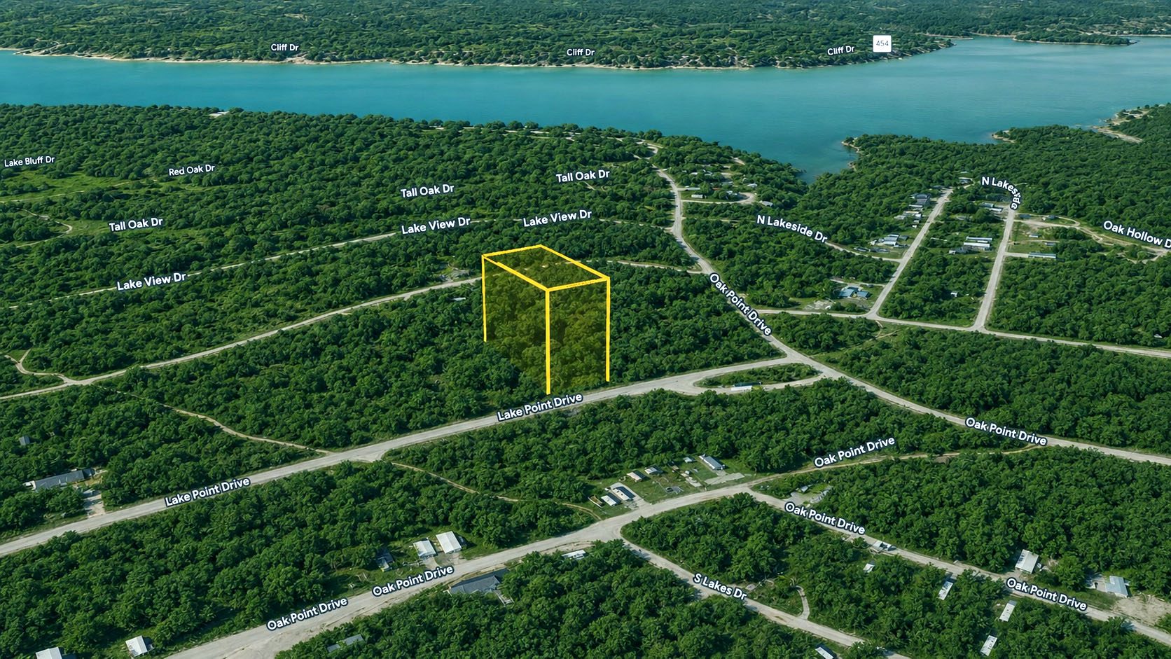
⚠️ Boundary lines shown are approximate and for illustrative purposes only. A professional land survey is recommended to verify exact property boundaries.
Photos & Images
📸 Property Photos
Featured ★
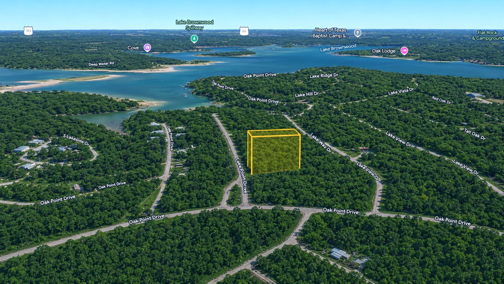
Photo 2
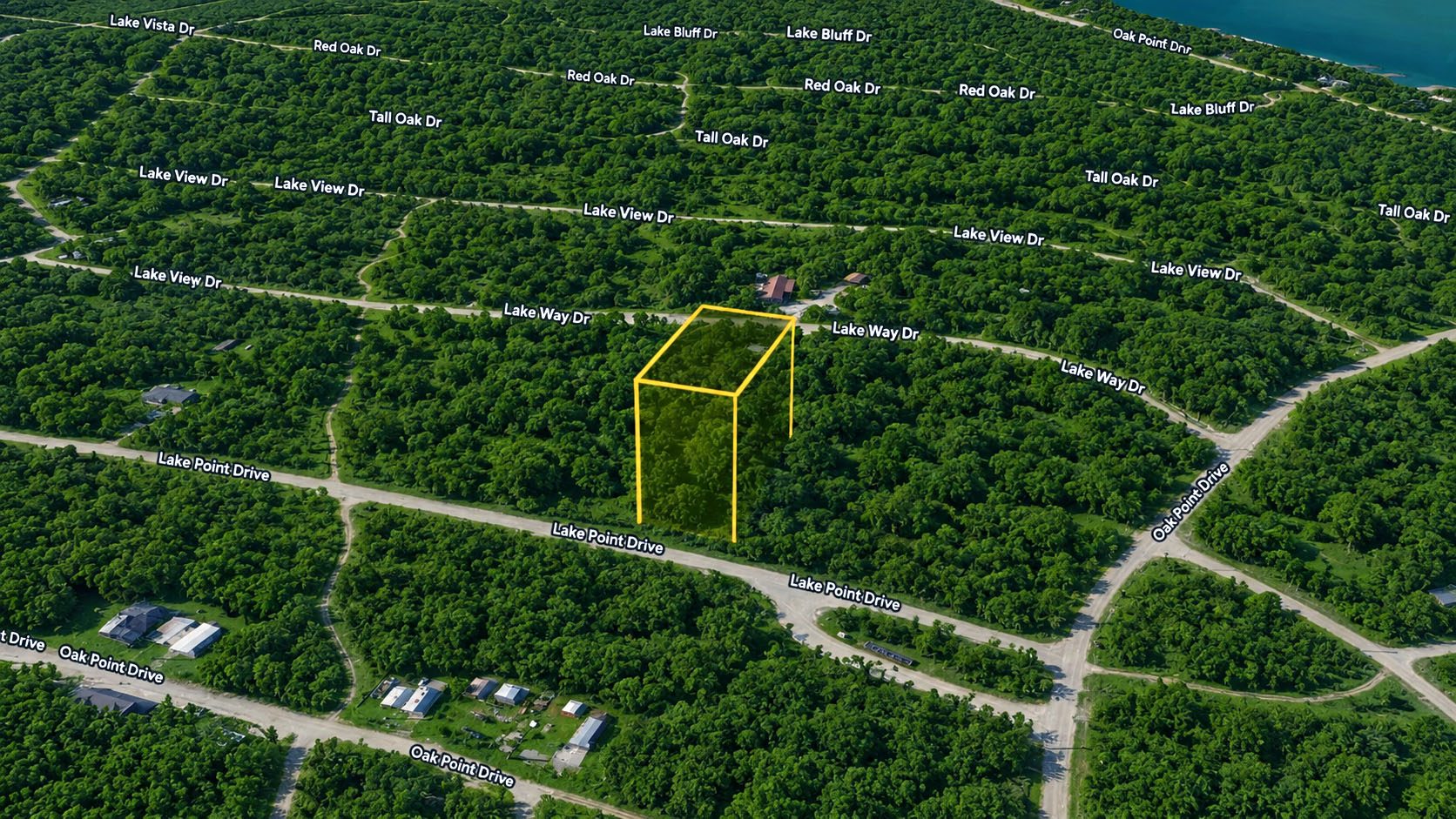
Photo 3
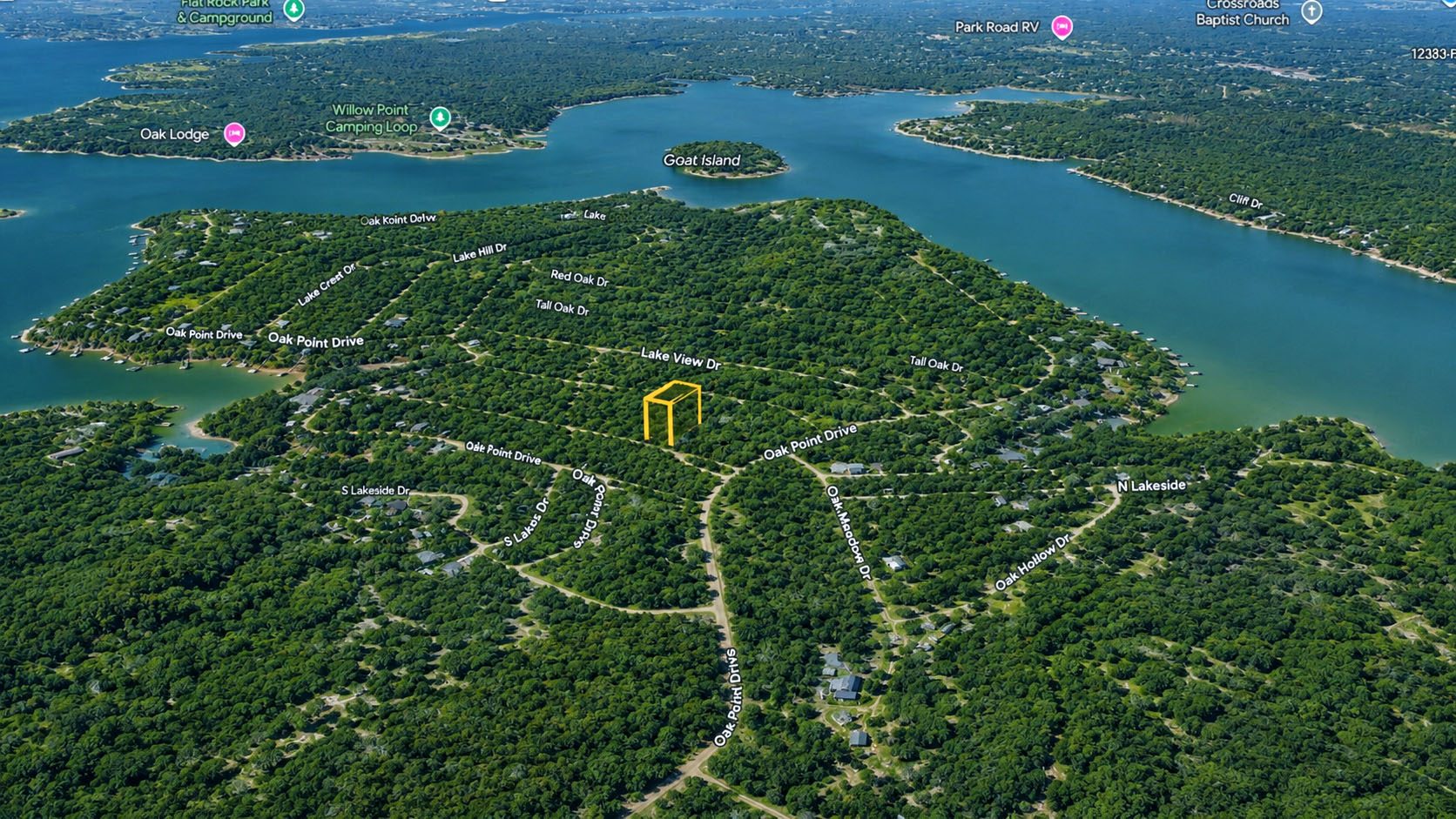
Photo 4
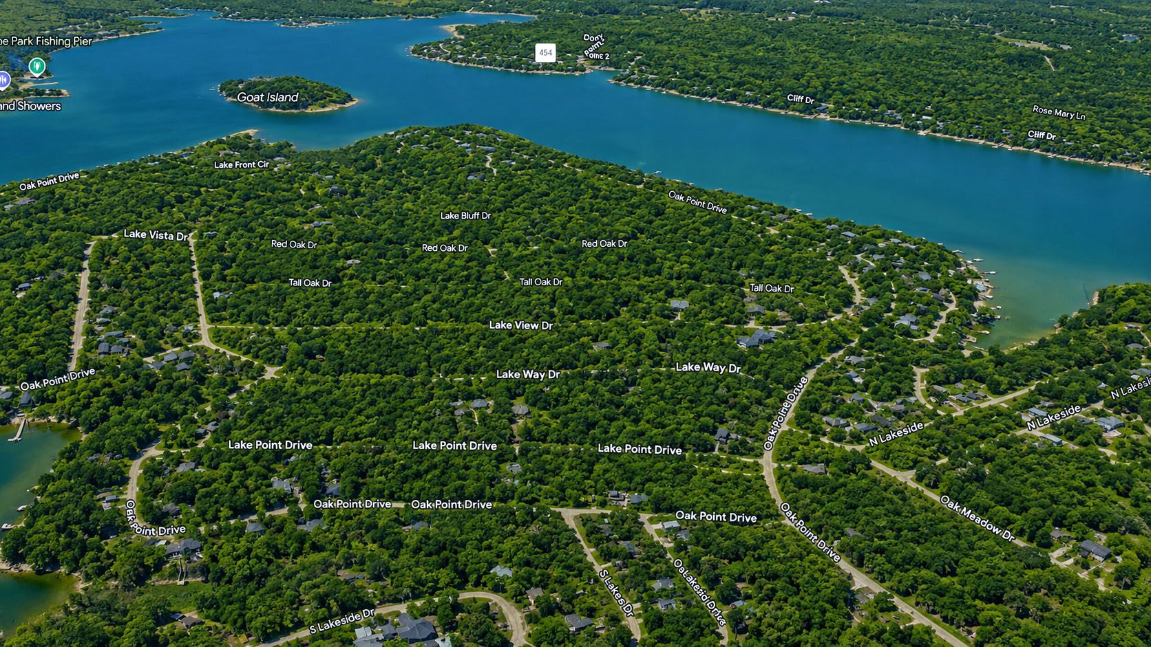
Photo 5
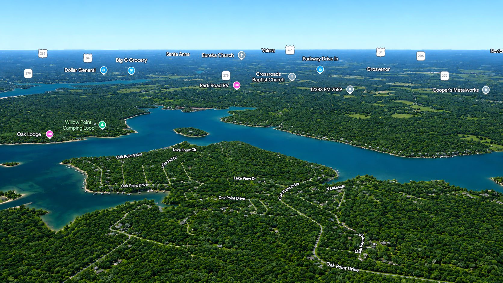
Photo 6
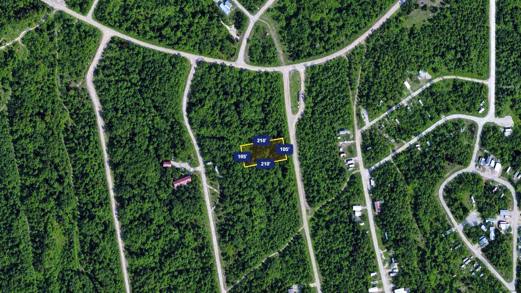
Photo 7
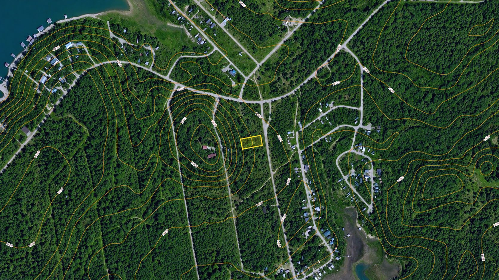
Photo 8
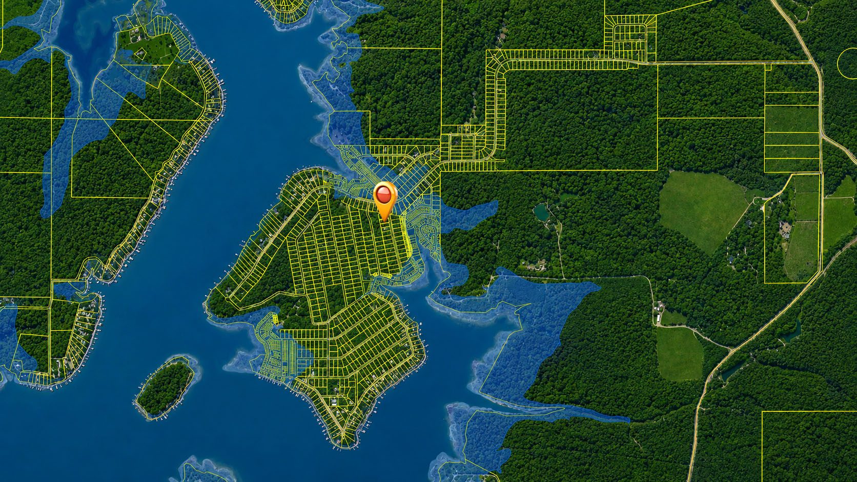
Photo 9

Photo 10

Photo 11

Photo 12

Photo 13

Photo 14
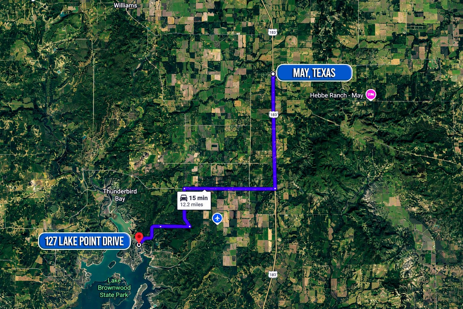
Photo 15
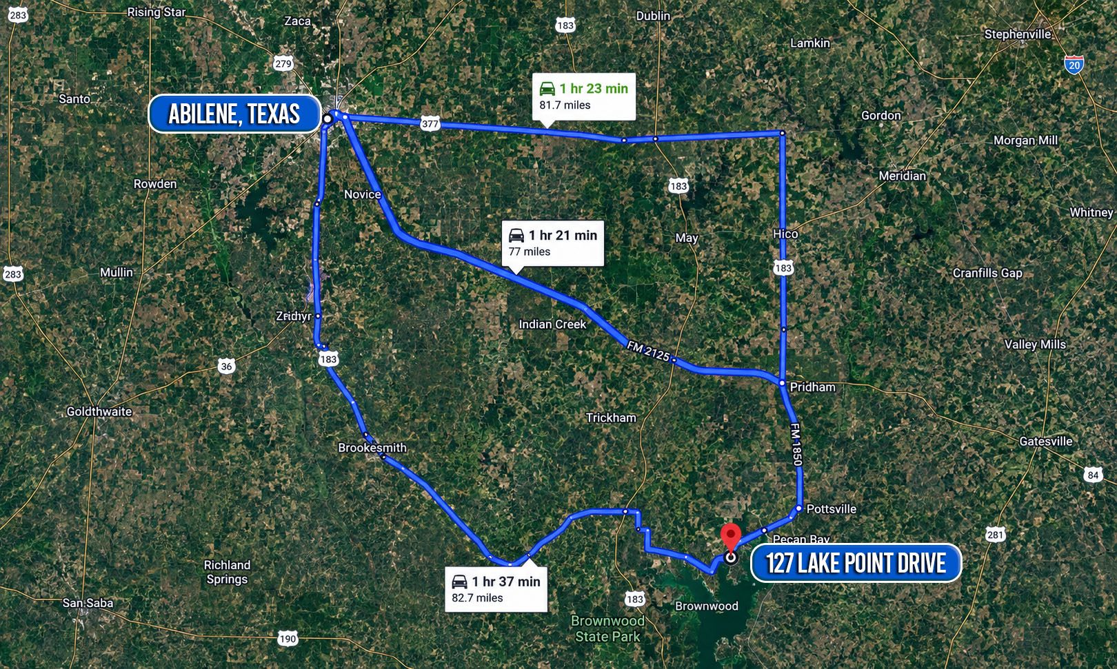
Photo 16

Photo 17

Photo 18

Photo 19

Photo 20
🎥 Videos
▶
Lake Escape Living Starts Here — Oak Point at Lake Brownwood
📍
Nearby Places
Finding nearby places…
📋 Property Report
📍 Location
Address
127 Lake Point Drive
City
May
County
Brown
State
Texas
Zip
76857
Latitude
31.8803713
Longitude
-99.0093721
Elevation
1462.60 ft
Municipality
May
🔑 Parcel ID
APN
76285
Robust ID
AAC7sVKIpfuW1Oh5
County FIPS
48049
🌿 Land Details
Acres (Deeded)
0.51
Acres (Calculated)
0.54
🌊 Flood & School
School District
May Independent School District
📋 Legal
Legal Description
OAK POINT PHASE TWO, LOT 990, ACRES .506
🌎 Climate Risk
Minimal · Non-burnable land
Fire Risk
1 / 10
Minimal
Flood Risk
1 / 10
Major
Heat Risk
7 / 10
Moderate
Wind Risk
5 / 10
Source: USFS Wildfire Hazard Potential, FEMA NFHL